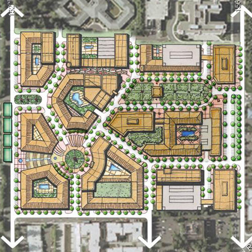
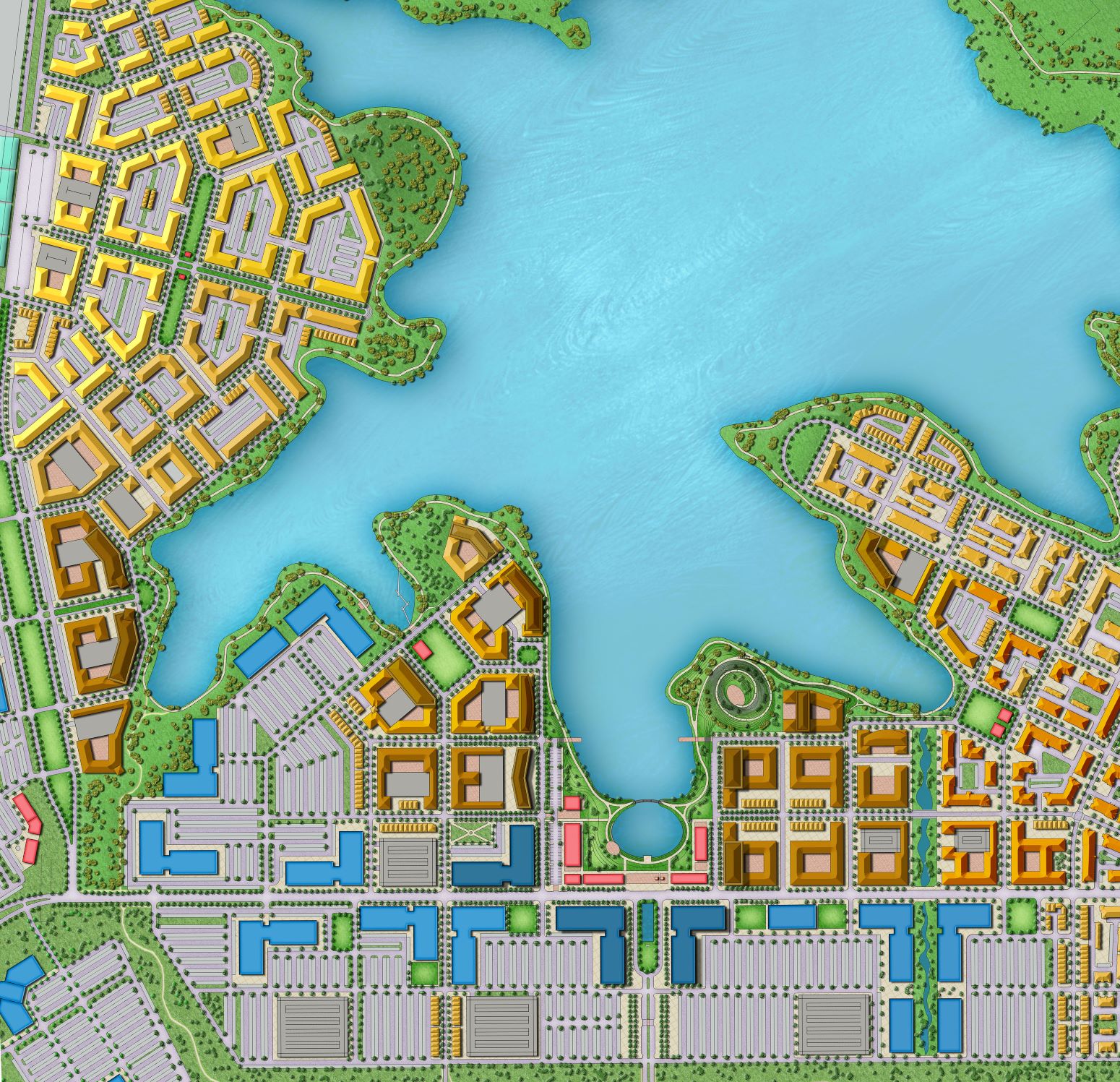
Expertise


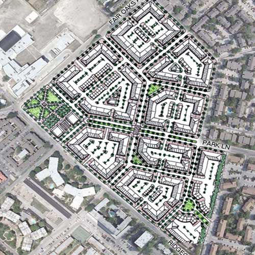
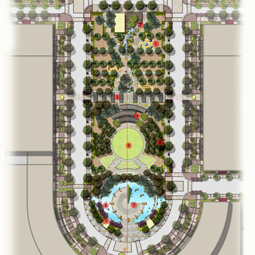
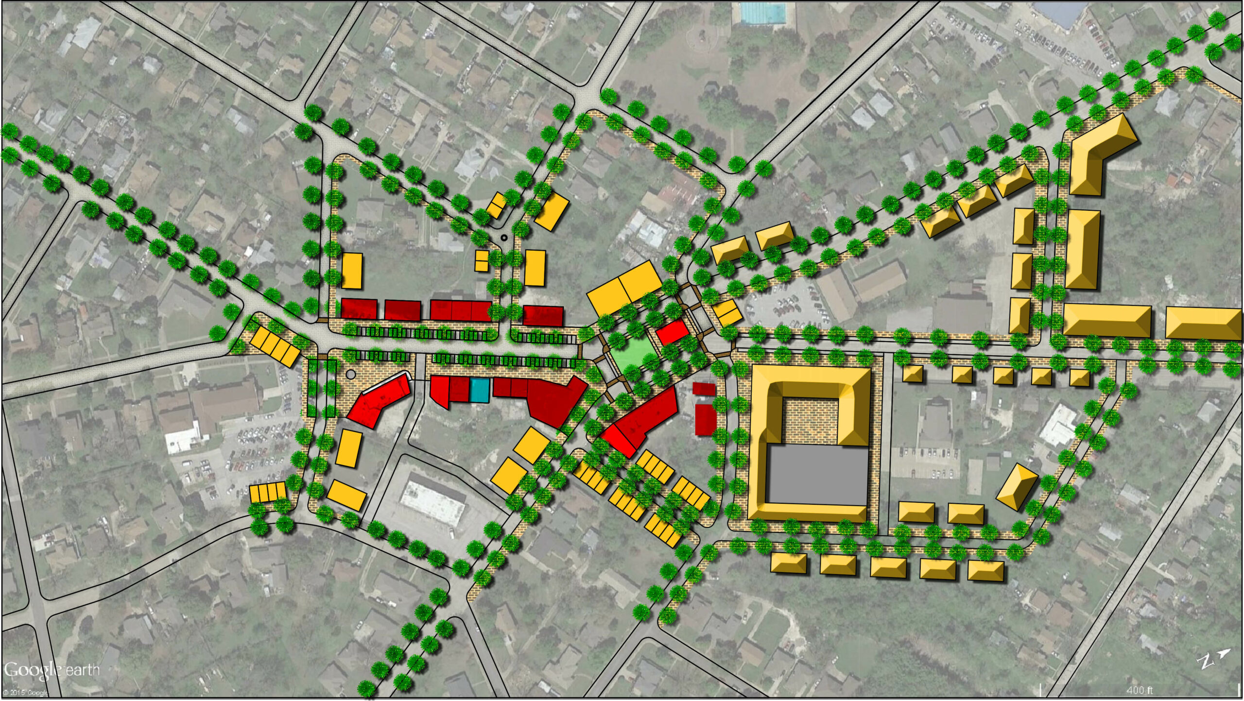
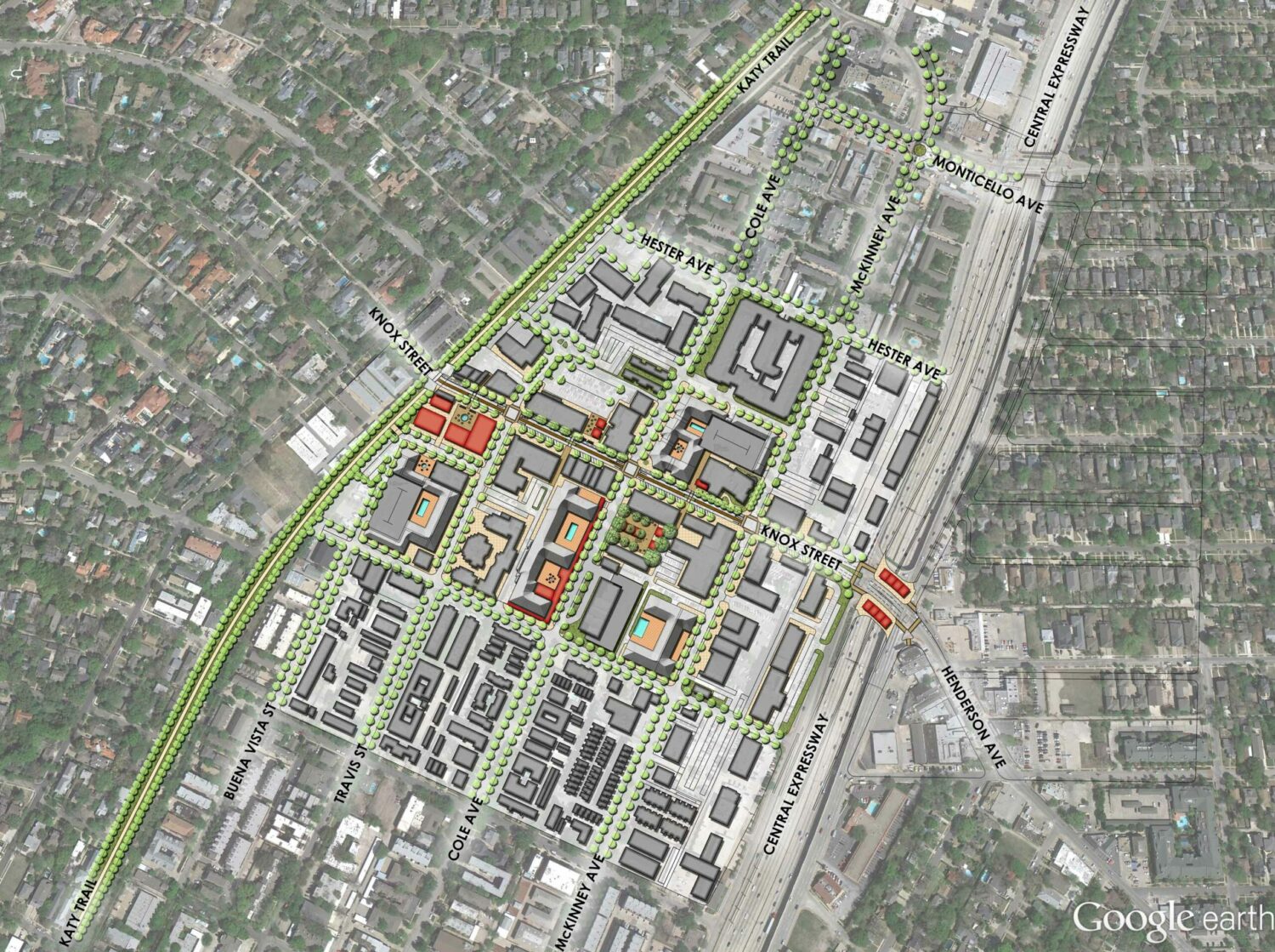
Our focus in the urban planning and design practice is on the interrelationship between movement infrastructure network design, urban design, and real estate market dynamics in order to deliver successful, lovable, sustainable places.  We convert car-centric places into human-scaled, walkable urban and desirable places that empower people through design to instill choice and accessibility into the context.

Scope and Skills:

Site planning, masterplanning, urban design, transportation network planning, capacity studies, traffic calming.

Projects


Five Points


Location: Dallas, TX

Space Between Design Studio generated initial planning sketch concepts for the Vickery Meadows/Five Points area of Dallas, a neighborhood lacking adequate public infrastructure and with aging 1960s era housing.  The plan developed a walkable public street, block and open space and phasing plan to deliver infrastructure, new housing, mix of uses, amenities, and tax base to pay for the rolling infrastructure improvement plan.

Grab and scroll for all imagery, click for full-size.

READ MORE

Harry Hines – McKinnon


Dallas, TX

A pet project of ours has always been to improve the walkability between the Crescent area of Uptown Dallas and Victory Park/American Airlines Center. However, once you pull the thread of the one-way street network the changes necessary (and improvements) mount up. The solution we discovered was to pull apart the Harry Hines/McKinnon confluence, convert them to two-way urban boulevards, create new developable blocks to front on Reverchon Park, further activating the park, and add new roundabouts as punctuation points that emphasize the transition to a pedestrian-friendly area and provide an improved entry experience into the city.

(grab and scroll to see all concept graphics; click to see full-size)

READ MORE

Henderson Cultural District Masterplan


Location: Henderson, NV

The City of Henderson, NV held a piece of vacant property and was looking to create a cultural district.  Members of Space Between Design Studio created a mixed-use masterplan with primary spine for planned cultural facilities, a streetscape plan, and a public open space plan.

READ MORE

Incremental Development Model


Location:

As part of a lecture series for the Dallas Institute and an article for D Magazine’s award-winning New Urbanism issue, SBDS created a series of drawings for how to incrementally revitalize and develop a disinvested area via tactical urbanism, walkable infrastructure and street network improvements, zoning and policy changes, and economic development strategies.

Grab and scroll for the full series of drawings.

READ MORE

Kings Highway Closure and Public Space


Location: Dallas, TX

SBDS created a concept to improve public safety by removing a segment of Kings Highway which as it currently exists creates a dangerous five-way intersection.  This concept would close that segment of the street to vehicular traffic, creating a safer four-way intersection, and repurposes the public right-of-way as public open space in an area lacking small-scaled, active yet intimate public spaces facilitating social and economic exchange.

READ MORE

Knox Street Public Realm Improvement and Area Redevelopment Plan


Location: Dallas, TX

In 2014, SBDS worked with the Knox Street Public Improvement District to analyze the neighborhood, identify challenges, and areas for improvement, then developed a series of streetscape, public realm, and policy improvements to help foster the neighborhood towards a more complete, walkable, mature, mixed-use neighborhood.

READ MORE

McKinney Avenue Two-Way Conversion Project


Location: Dallas, TX

SBDS led the effort to revert McKinney Avenue in Uptown Dallas to two-way traffic (including Cole and Carlisle) since 2014 including building consensus among area stakeholders, passing the Thoroughfare Plan Amendment, and assembling the project funding, which included 2017 bond funds, local neighborhood funding, and Congestion Mitigation Air Quality (CMAQ) funding through North Central Texas Council of Governments (NCTCOG).

READ MORE

Oak Farms


Location: Dallas, TX

SBDS developed the concept to reconstruct the Houston and Jefferson Street Viaducts connecting downtown Dallas to Oak Cliff in order to revert Jefferson to two-way traffic, make Houston a multi-modal corridor, and create additional developable land for increased tax base.

Grab to scroll; click to embiggen to view all imagery.

READ MORE

Old Oak Cliff Development Plan


Location: Dallas, TX

SBDS created an area redevelopment plan for the Old Oak Cliff neighborhood in Dallas, Texas including strategies for preserving significant buildings, relocating and redeveloping an aging city facility, and building a shared central parking garage to reduce the demand and need for provision of mandatory off-street parking.  There are also recommended streetscape boulevard improvements for Zang and Jefferson as well as public realm improvements at Turner Plaza.

READ MORE

Redmond, WA Transit-Oriented Development Plan


Location: Redmond, WA

Members of Space Between Design Studio created a masterplan for a defunct hospital site in order to re-zone and entitle land for redevelopment as a transit-oriented development in Redmond, Washington.  The site had interesting topography where it is fairly flat on the eastern half of the site and then falls off fairly drastically on the western half.  The SBDS design solution centered on maintaining ADA accessibility across the site by connecting the eastern half with a standard rectilinear grid network that cants diagonally for the western half in order to reduce slope of the primary street network and then create interesting terracing and public access stairways making additional connections while maximizing views towards downtown Seattle.

READ MORE